Thursday, August 31, 2006

Alaska floats my boat!


I loved Alaska to death! Here are only a handful of photos of my trip. I've included ones from my travels excepting my kayak trip to Kenai Fjords. I'll do a separate post on those, since that was the highlight of my trip in many ways.

In the meantime, here are some photos to whet your appetite. BTW: The boats above were docked in the southern port town of Seward, stopping place for many cruise ships.


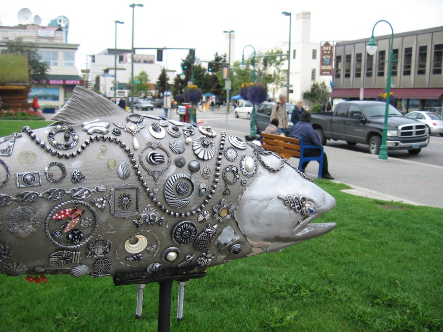
Anchorage, besides having a coffee shop on every corner (that's where I got the Starbucks in my hand), proudly displays some local wildlife artifacts on its streets. This moose probably poses with hundreds of tourists every day. The fish, below, is smack in the middle of downtown. It is one of many designed by local artists.


Train travel is one of the only ways to go in Alaska if you don't have your own car. There's really only one main highway that runs north/south from Seward to Fairbanks. I took the train on a few different trips. This one ran from Seward to Anchorage.


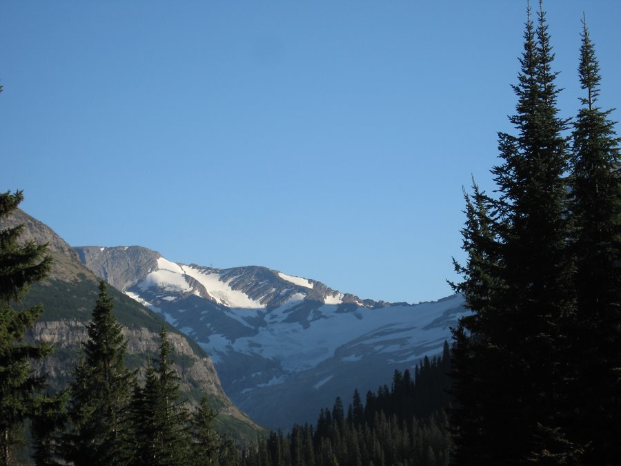
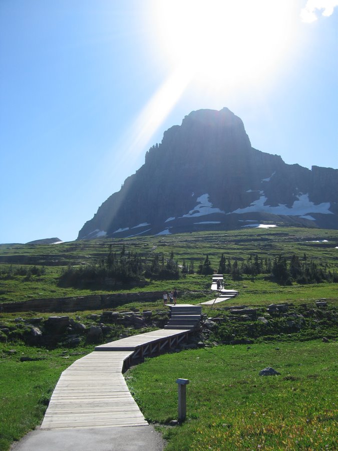
On my northbound train ride, I snapped about 100 photos of mountains, glaciers, snow-capped mountains, and creeks.


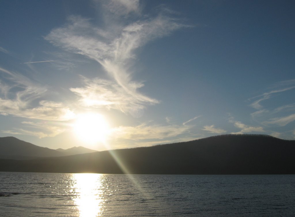
Seward, below, was my home for 3 days and nights. Two of those days were rainy, gray, cold, and generally miserable. The third day of glory made up for it all. The sun shone brightly, the water sparkled, the mountains stood green and proud over the landscape. It was one of those days God hand tailors.


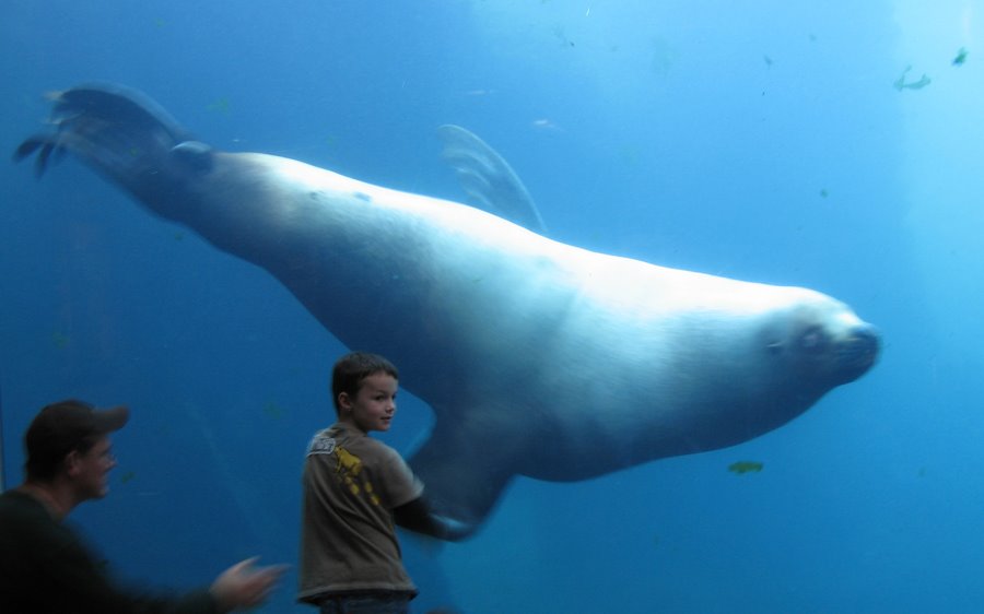
One of my toursity activities included a visit to the Sea Life Center in Seward. There, this 2,000-lb sea lion teases visitors.


This sign at the Sea Life Center speaks for itself:


http://www.alaskasealife.org/

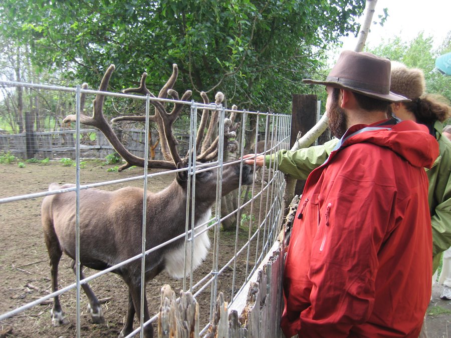
One of my train trips took me north to the small town of Talkeetna. There, I met some fellas from the Maryland area. We walked around the small town together and took in the sights, including this real-live reindeer!


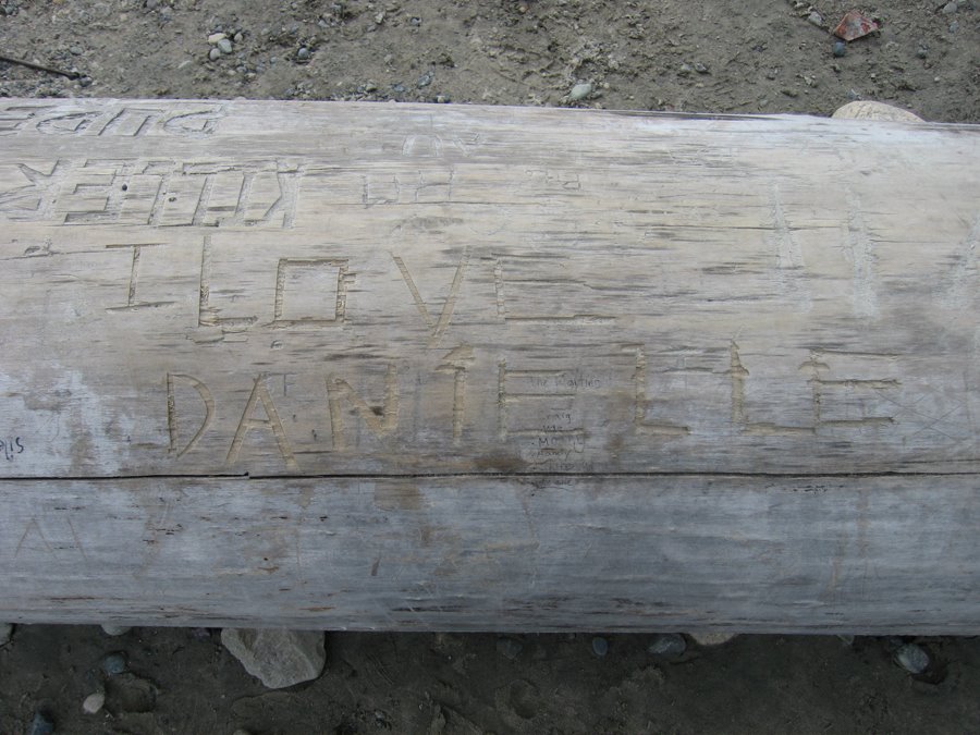
I chilled out for awhile on this washed-up log on the banks of the Talkeetna River.


Someone had carved into the log "I love Danielle." Did you doubt I would take the photo?

Thursday, August 10, 2006

VC: Andrews, right?

This post has nothing to do with my travels. Well, trangentially, if anything.

I was driving along Hwy 101 in the Olympic Peninsula recently, and I was talking to myself (as often happens with solo travelers). It occured to me I could be rattling off utter nonsense, and no one would be the wiser. So, I started rattling off some nonsense words, just for the fun of it. That led me to wonder how much I knew about the Vietnam War. I have no idea why this topic in particular sprang up. I think some of the nonsense words may have sounded like a term from that war.

So, I began to brainstorm: What facts did I know about the Vietnam War? Here's what I came up with. (I did not use the Internet or any resource books.) It's not impressive.

* South Vietnam was communist and wanted North Vietnam to be communist, too.

* It started for the U.S. when Kennedy sent some troops over in 1963 to help settle things down in the region. (I got this from the movie "Dogfight.")

* The draft was established, leading folks to burn draft cards and flee to Canada (I know this in part from the musical "Hair")

* Vietcong was the name for the ... bad guys?

* The Ho Chi Minh trail was ... something. (You could be on the "right side" of the HCM trail, as Baby's sister remarked to her in the movie "Dirty Dancing")

* Ho Chi Minh was a leader.

* Our troops trained in Parris Island (I learned this from the Billy Joel song).

* It was a "dirty little war," with U.S. troops confounded by all the foreign, jungle-like terrain. (Quote from "Hair")

* U.S. troops burned villages, killing women and children (I've seen this in lots of movies)

* Charlie was the name for ... the enemy?

* Prostitution was rampant among Vietnamese women and U.S. soldiers (got this from "Miss Saigon" as well as movies)

* Little babies were born who had American fathers and Vietnamese mothers.

* The South won the war, and U.S. troops eventually withdrew.

* It ended sometime in the early 1970s -- 73, maybe? I think Ford was president. (I know this because our family was in Canada from 1967-1973. Coincidence? Hmmmm)

* The rock opera "Hair" was written in direct response to the war.

* Oliver Stone commented on it in his movie "Platoon." That was his, right?

* Some South Vietnamese fled the country and came to the U.S. (A girl in my high school had done this with her family.)


OK. So that's about the extent of it. You'd never have gotten this glimpse into my ignorant mind if I were sleeping like I should be at 1:18 a.m.

Good night.

Monday, August 07, 2006

GNP: The cold one

Glacier National Park made all other places look dreary. The park is in northern Montana on the border of Canada. Snow-capped mountains, cool breezes, wildflowers, streams, clear blue skies and zoo animals wandering about mark this park.


Above is Jackson Glacier, which started its "retreat" in about 1860, scientists hypothesize. If the Earth keeps on this heating pattern it seems to be on, some scientists predict many glaciers will rapidly melt and disappear in the next few decades. So I decided to take a trip north to catch 'em before they're gone.


These mountain goats, belonging to the deer family, take little notice of humans climbing the mountain alongside them. These creatures were munching the grasses on the mountains at Logan's Pass.


It took a swervy, curvy 45-minute drive to reach the Pass, above. Then I hiked, yes hiked, in my flip-flops about 1.5 miles to see ... the other side of the mountain basically. I made some new friends, though, pictured here, in addition to my sore tootsies.


These weary feet brought me through Logan's Pass. I believe I actually broke a toe walking this path. Flip-flops are not the GNP-approved list of footwear for hiking, methinks.


Lake McDonald is the longest lake at Glacier National Park; it's surrounded by mountains, providing spectacular sunsets and ogling opportunities. I camped at the nearby KOA for two nights. One day, I went whitewater rafting (this is swiftly becoming a favorite activity of mine). The other I spent exploring GNP.

Don't feed the animals:And just in case you were unsure, the park rangers want you to know you are not alone in the woods:

Montana on my mind


But what is it?: I saw many signs for the Continental Divide on my journey, starting in South Dakota. This one is on Highway 90 approaching Bozeman, Montana. I still don't know what it is, exactly. (The divide, not Bozeman.) It appears to occur in various different places. Someone in Wisconsin told me that part of the water in neighborhoods flows into the Mississippi and in other parts it flows into the Atlantic because of the Continental Divide. But is it one thing? Many things? Cracks in the Earth? Where was I during Earth science class?


He's big. He's Mike: Gotta love this sign in front of the Museum of Natural History in Bozeman, MT. Below is the Mike referred to. I believe I also saw the largest T-rex skull in existence (yet) at this museum. (I know it was the largest, I just don't recall if this was the museum or not. ("Seen one, seen 'em all" is setting in.)


Drive on: Besides being the home to the first food co-op I've ever visited, Bozeman also is home to this driver, with an eclectic collection of bumper stickers.


Life lesson: I left my camera's battery charger in the time share in Vegas, so I was without a camera for a short while. (I missed photographing Yellowstone National Park, sadly.) I eventually swallowed my pride and bought a couple of throwaways. These I used to shoot the Lewis and Clark Caverns about 30 miles west of Bozeman. The caverns hover at around 55 degrees and, at one point, I was a mile above sea level while still being underground. I saw one bat. Oh, the life lesson? Pack an extra battery. A charged one.

As a point of interest: Bozeman is the one-time home of dry-humored NPR commentator and author of "Take the Cannoli" Sarah Vowell. If you've seen The Incredibles, you will recognize her voice from the character "Violet."

Sunday, August 06, 2006

Guess the state


Wheat from the fields in this state comprise the second largest crops in the country.


"Indians, fur traders, military expeditions and settlers" traveled here, according to a historical marker at this site.


Some people I spoke to who live in this state called this area a desert.

Warning! The photo below might be a dead giveaway for those who have not guessed the state yet. I will tell you the answer in the "comments" part of this posting.


I was totally excited to see these apples at a grove off the highway. Of course, I had to stop and take a photo. I didn't steal any fruit, though.