Montana on my mind
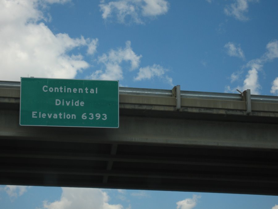
But what is it?: I saw many signs for the Continental Divide on my journey, starting in South Dakota. This one is on Highway 90 approaching Bozeman, Montana. I still don't know what it is, exactly. (The divide, not Bozeman.) It appears to occur in various different places. Someone in Wisconsin told me that part of the water in neighborhoods flows into the Mississippi and in other parts it flows into the Atlantic because of the Continental Divide. But is it one thing? Many things? Cracks in the Earth? Where was I during Earth science class?
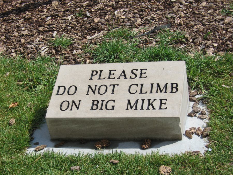
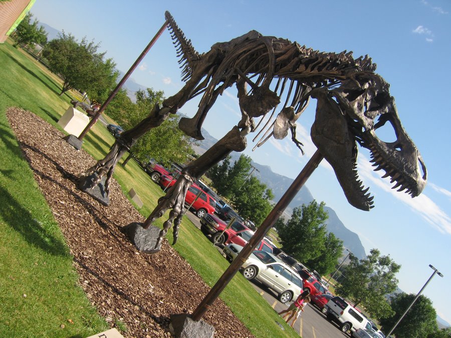
He's big. He's Mike: Gotta love this sign in front of the Museum of Natural History in Bozeman, MT. Below is the Mike referred to. I believe I also saw the largest T-rex skull in existence (yet) at this museum. (I know it was the largest, I just don't recall if this was the museum or not. ("Seen one, seen 'em all" is setting in.)
Drive on: Besides being the home to the first food co-op I've ever visited, Bozeman also is home to this driver, with an eclectic collection of bumper stickers.

Life lesson: I left my camera's battery charger in the time share in Vegas, so I was without a camera for a short while. (I missed photographing Yellowstone National Park, sadly.) I eventually swallowed my pride and bought a couple of throwaways. These I used to shoot the Lewis and Clark Caverns about 30 miles west of Bozeman. The caverns hover at around 55 degrees and, at one point, I was a mile above sea level while still being underground. I saw one bat. Oh, the life lesson? Pack an extra battery. A charged one.
As a point of interest: Bozeman is the one-time home of dry-humored NPR commentator and author of "Take the Cannoli" Sarah Vowell. If you've seen The Incredibles, you will recognize her voice from the character "Violet."
posted by Danielle P at 2:10 AM
![]()


1 Comments:
From Wikipedia:
The Continental Divide or Great Divide is a ridge of mountains in North America and Central America which separates the major watershed that flows west into the Pacific Ocean from the ones that flow north into the Arctic Ocean and south-east into the Gulf of Mexico. Most of the divide follows the crest of the Rocky Mountains. This is a simplified view, however; many areas of North America drain internally.
The divide begins at Cape Prince of Wales in Alaska and heads southwards into the Yukon Territory and British Columbia in Canada, continuing south through Montana, Wyoming, Colorado, and New Mexico in the United States. It then goes further south into Mexico and Central America following the crest of the Sierra Madre Occidental.
The southern portion of the border between the Canadian provinces of British Columbia and Alberta is defined by the Continental Divide.
Triple Divide Peak in Glacier National Park in Montana forms the triple point at which waters flow to the Pacific, Atlantic and Arctic Oceans. (By another calculation, if the waters of Hudson's Bay are considered separate from the Arctic ocean a lesser triple divide is within the Columbia Icefield in British Columbia.)
The Continental Divide Trail follows the divide through the U.S. from the Mexican border to the Canadian border.
-----------------------
Hope this answers your question.
Chris
Post a Comment
<< Home